Bookbot

Immagini d'America: Pennsylvania

Questa serie offre un viaggio avvincente attraverso il passato della Pennsylvania, portato in vita da una ricca collezione di fotografie storiche. Ogni volume cattura lo spirito unico di città e comunità del 'Keystone State', evidenziando le loro distinte culture e tradizioni. Esplora luoghi iconici, eventi dimenticati e la gente comune che ha plasmato la storia di questa importante regione americana. È un'esplorazione visiva del tempo che attrae sia gli appassionati di storia che la gente del posto.

Haverford College Arboretum
Hellertown
C.F. Martin & Co.
Ligonier Valley
Mining Disasters of the Wyoming Valley
Warrington Revisited

Ordine di lettura consigliato

  • Warrington Revisited

    • 128pagine
    • 5 ore di lettura

    At the time of Warrington Township’s founding in 1734, few landowners lived on Bucks County’s fertile soil. The history of the township is one of gradual growth and development. From unbroken wilderness grew small clusters of families forming villages. Warrington consisted of four villages: Warrington, Neshaminy, Pleasantville, and Tradesville. In the mid-1800s, the township’s landscape was made up of family farms, with agriculture as the main industry. In the late 1920s, the first small housing developments were built. By the early 1960s, larger housing developments and shopping centers had replaced many farms. Once lined with lush fields of crops and trees, the Doylestown–Willow Grove Turnpike/Easton Road/Route 611 has seen the most change throughout time. Historically significant families, including the Barnesses, Coggiolas, Cornells, Craigs, Holberts, Leventhals, Mayers, Pauls, Penroses, Wileys, and Worthingtons, created well-known businesses along this road on which they lived. Today, this thoroughfare has little historic substance to offer its current residents.

    Warrington Revisited
  • Ten-year-old Willie Hatton was excited to visit his father at the Avondale Mine on the morning of September 6, 1869. Sadly, Willie would die in his father's arms that day, and so would 108 other miners, all victims of a horrific fire that tore through the shaft, trapping the men and boys and blocking the only exit. The communities of the Wyoming Valley know firsthand the human cost of the anthracite industry. From a cave-in at Twin Shaft to an explosion at the Baltimore Tunnel to the Susquehanna River crashing through the roof at Knox, thousands of miners left for work in the morning never to return. Sadly, few of the tragedies could be called accidents. Profits took precedence over safety, leaving workers to pay the price for negligence, corruption, and greed.

    Mining Disasters of the Wyoming Valley
  • C.F. Martin & Co.

    • 130pagine
    • 5 ore di lettura

    Focusing on craftsmanship and innovation, C.F. Martin & Co. showcases the evolution of acoustic guitars through six generations of the Martin family. This enduring family business, the oldest stringed instrument maker, has thrived since 1833, navigating historical challenges such as the Civil War. The book features captivating images that highlight the company's buildings, employees, musicians, and the exquisite instruments that define its legacy and status as a leading acoustic guitar producer in America.

    C.F. Martin & Co.
  • Nestled in the Saucon Valley, Hellertown lies just south of Bethlehem, bordered on the west by the Saucon Creek. While the creek derives its name from the Native American word sakunk, meaning place where a small stream enters into a larger stream, the town inherited its name from Christopher Heller and his descendants who settled the area in the mid-1700s. The 1800s brought a wave of Deutsch (German) immigrants to this corner of Pennsylvania Dutch (Deutsch) country. During the latter years of the nineteenth century and the first half of the twentieth century, Hellertown resembled any small town in America. Residents participated in world wars and suffered through the Great Depression while keeping their faith in democracy. Hellertown tells the story of these residents through more than two hundred photographs that have been donated to the Hellertown Historical Society during the last century. It shows the long-gone train station, Wagner's Grist and Saw Mill, and the Thomas Iron Company. Hellertown also offers snapshots of Big Bertha, the 1920 Dewey Fire Company No. 1 in action, a Sears home, the Hellertown girls' croquet team of the early 1900s, and some of the most influential residents from the past one hundred fifty years.

    Hellertown
  • In 1833, when the first 23 students arrived at what is now Haverford College, they found one school building surrounded by nearly 200 acres of farmland, woods, and a small creek. The story of how this landscape evolved into the park-like setting of today's campus is told through images spanning 150 years. Students and neighbors alike now enjoy an outstanding collection of trees, woods, a duck pond, and a nature trail. Reminiscences of retired staff and faculty children who grew up here, coupled with descriptions by the school's early students and professors, reveal a fascinating history. Here are majestic trees: oaks planted in 1834, American elm survivors of a devastating disease, and newly planted giants of tomorrow. Gardens once flourished where buildings now stand, and cows grazed on today's athletic fields. Students organized bobsled races down the lawn in the 1880s, and skaters enjoyed the frozen pond in the 1950s.

    Haverford College Arboretum
  • Jewish Pittsburgh

    • 128pagine
    • 5 ore di lettura

    By the mid-19th century, Jews from German lands began settling in Pittsburgh, later to be followed by Jews from the Russian and Austro-Hungarian Empires and Romania. They founded businesses and organizations such as Giant Eagle, Kaufmann's Department Store, Montefiore Hospital, the Pittsburgh Playhouse, the Civic Light Opera, and the Pittsburgh Pirates. Sophie Masloff became the first woman and the first Jew to serve as mayor, and civic reformer and lawyer A. Leo Weil, philanthropist Leon Falk Jr., and social justice crusader Florence Reizenstein all had schools named after them. From Allegheny City and "the Hill" to Squirrel Hill and the East End, the Jewish population preserved its distinct core community and contributed to its adopted city in multiple ways. Today, it numbers more than 40,000, and their story is one of grit, determination, risk taking, hard knocks, and no small measure of success.

    Jewish Pittsburgh
  • Pittsburgh's Bridges takes a comprehensive look at the design, construction, and, sometimes, demolition of the bridges that shaped Pittsburgh, ranging from the covered bridges of yesterday to those that define the skyline today.Pittsburgh is the "City of Bridges," and what remarkable bridges they are! The area's challenging topography of deep ravines and mighty rivers - the Monongahela, Allegheny, and Ohio - set the stage for engineers, architects, and contractors to conquer the terrain with a variety of distinctive spans. Many were designed to be beautiful as well as functional. While other cities may have one signature bridge, Pittsburgh has such a wide variety that no single bridge can represent it.

    Pittsburgh's Bridges
  • Steelton

    • 130pagine
    • 5 ore di lettura

    The book explores the rich history of Steelton, an industrial hub known for its ethnic diversity and productivity along the Susquehanna River. It highlights the contributions of various immigrant groups, particularly Slavs and Italians, alongside African Americans who worked at Bethlehem Steel Company. The narrative delves into the town's vibrant religious life, athletic achievements, and the pride of its residents in their military service during the world wars. Vintage images capture the essence of this unique community and its legacy.

    Steelton
  • Promised Land State Park

    • 128pagine
    • 5 ore di lettura

    The book showcases the rich history of Promised Land State Park in northeastern Pennsylvania through over 200 unique images, many published for the first time. It highlights the park's significance as a cherished destination for generations of visitors, preserved by various organizations and individuals. The compelling visuals offer insights into the park's heritage, making it a valuable resource for both history enthusiasts and nature lovers.

    Promised Land State Park
  • Cranberry Township

    • 128pagine
    • 5 ore di lettura

    It is hard to imagine a version of Cranberry Township that was comprised of lush forests, gently rolling hills, and cascading waves of open fields. For the settlers who arrived here in the late 1700s, it was an Eden of abundant opportunity--tranquility that proved irresistible. They purchased hundreds of acres, built self-sustaining farms, and planted their roots. These pioneers had names like Graham, Garvin, Duncan, Meeder, Rowan, and Goehring, and many of their descendants still remain. While its name pays homage to the marshy bogs that produced succulent cranberries, its heritage is rooted in humble beginnings that remained largely untouched for centuries. Only with the dawn of an expanding highway system beginning in the 1950s did Cranberry Township begin its rapid transformation from farm community to suburban hot spot.

    Cranberry Township
  • Plum Borough

    • 130pagine
    • 5 ore di lettura

    Plum Township, which later reorganized as Plum Borough, was founded on December 18, 1788, and westward pioneers soon chose to settle in the region. William McJunkin, an Irish emigrant and one of the earliest settlers, came to Plum Borough and in 1790 was granted a tract of land he came to call "Greenfield." In the 19th century, Plum Borough was an agricultural gold mine for the brave settlers who wished to emigrate from their East Coast homesteads. During the 20th century, Plum Borough emerged from being an agricultural suburb of the Steel City to become a vibrant residential community with a wondrously bright future.

    Plum Borough
  • For nearly 80 years, Pennhurst State School and Hospital was a reminder of how society viewed and treated people with intellectual disabilities. Over its existence, Pennhurst was home to more than 10,600 people. Many spent decades there, working to keep the institution running by performing various jobs. While some enjoyed the lives they had fashioned for themselves at Pennhurst, for many others, life there was crushing. Pennhurst also played a central role in the lives of its employees and in the rural Pennsylvania community where it was located. Controversy plagued the institution for its entire existence, and it is remembered primarily as a place where bad things happened. However, it was much more than that. This book provides a window into that separate world, reminding those who were part of it of what they saw and did there and giving those who know only what they have heard or seen a different picture of what Pennhurst truly was.

    Pennhurst State School and Hospital
  • Cornwall

    • 130pagine
    • 5 ore di lettura

    Cornwall was founded in 1737 after a tremendous amount of iron ore was discovered in three hills. Mining started in earnest in 1742 when a charcoal furnace was constructed in Cornwall to smelt the iron ore. Operations of open pit and underground mining continued for more than 230 years until June 1972 when Hurricane Agnes flooded the mine. The iron ore was used to cast cannon and shot for the Continental army and later to construct our country's buildings, bridges, and infrastructure. Vintage images culled from area archives illustrate the mining history, community culture, and development of the borough of Cornwall.

    Cornwall
  • Waynesburg

    • 128pagine
    • 5 ore di lettura

    Waynesburg was founded in 1796 as the county seat of the newly formed Greene County, Pennsylvania. The state's General Assembly approved its formation after a petition was submitted by the citizens of this southwesternmost corner of the state. The people desired a more convenient location to transact their legal affairs, not wanting to ride the rugged roads north 30 miles to the county and town of Washington. The new county and its capital were named in honor of soldiers who helped General Washington to win the Revolutionary War, Nathaniel Greene and Mad Anthony Wayne, respectively. Waynesburg travels back to the early days of the area's growing years, documenting the evolution of High Street from the time of dirt roads to brick pavers and revisiting the Downey House and its tragic fire, the men of Company K, the Waynesburg Brewery, the Soldiers and Sailors Monument as it was built, the Hookstown Cemetery, the Courthouse Square, the Waynesburg College campus, and other icons of local history.

    Waynesburg
  • Sunbury

    • 128pagine
    • 5 ore di lettura

    Explored by Europeans as early as 1615, Sunbury developed into a transportation hub because of its location at the confluence of the Susquehanna River. Later, it became important as the site of Thomas A. Edison's first successful installation of a three-wire electric lighting system on July 4, 1883, at the City Hotel, which today is called the Edison Hotel and is a cultural hub for the area. Sunbury is also an important historic district, showcasing over 200 examples of Federal, Italianate, Romanesque, and Second Empire architecture in the hotels, homes, public buildings, and taverns from the canal days to the grander Victorian era.

    Sunbury
  • The book explores the rich history of African Americans in Mercer County, highlighting their two-century journey toward progress and freedom. It details the role of the Underground Railroad, the establishment of the Freedom Church, and the creation of Pandenarium for freed slaves. The narrative also covers the impact of 20th-century southern migrants in the steel industry and the significance of community organizations like the Twin City Elks. The story spans from early land acquisitions to contemporary celebrations of Juneteenth, illustrating a resilient legacy.

    African Americans in Mercer County
  • Warren County's townships, nestled in the northwest corner of Pennsylvania, were originally formed from the land grants awarded by William Penn and his descendants to many individuals and families. Warren County was established March 12, 1800, and grew in prosperity from agriculture, lumber, oil, rafting, railroads, and tanning. The Allegheny National Forest and Allegheny River both provide magnificent arenas for many local recreational and business opportunities. In 1965, Warren County became home to the Kinzua Dam as the flooding of Corydon and parts of Kinzua Township created the reservoir. While most of the eastern and southern parts of the county are broken and hilly, the northeastern section is mostly glacial territory. Hearts Content in Watson Township is one of the few virgin timber tracts remaining in the Allegheny National Forest.

    Warren County
  • Established in 1757, Silver Spring Township is the fourth-oldest township in Cumberland County. The area was founded by the Scots-Irish, who cleared the area for farming and built taverns, inns, and mercantile businesses. Eventually, the villages of Hogestown and New Kingstown were established; these two villages are still home to many township residents. Rich in history, Silver Spring is home to the Silver Spring Presbyterian Church, the oldest church west of the Susquehanna River. Between 2012 and 2013, Silver Spring Township was the fourth-largest growing township in Pennsylvania. What were once heavily traveled Native American trails have become well-traveled highways and byways, and within a few hours, travelers can be in New York City, Philadelphia, Baltimore, and Washington, DC. Through vintage photographs, Silver Spring Township shares and celebrates the history of this well-preserved community.

    Silver Spring Township
  • In 1914, Philadelphia was the third largest city in the United States with a population of just over one and a half million people. It was fitting, therefore, that during World War I, Philadelphia mobilized itself for the war effort perhaps more than any other large American city. Nicknamed the "Workshop of the World," Philadelphia saw its manufacturing and textile companies converted, almost overnight, to full wartime production. Meanwhile, private and city-sponsored organizations sprang up to send relief to the people of war-torn Europe and prepare for the possibility of American involvement. The Great War would forever alter the city's landscape and its people. Architecturally, demographically, and socially, Philadelphia would experience sweeping change, and the people of William Penn's "greene country towne" would come together as never before to support the war effort at home and their boys abroad.

    Philadelphia: The World War I Years
  • Wellsboro

    • 128pagine
    • 5 ore di lettura

    Wellsboro, the county seat of Tioga County, owes much of its vitality to dense forests, abundant wildlife, and mountainous terrain. Named by the National Park Service as a Natural Landmark in 1968, nearby Pine Creek Gorge was introduced by George Washington Sears, better known as "Nessmuk," in 1860 and later publicized as "the Grand Canyon of Pennsylvania." A weeklong Laurel Festival, organized in 1938, celebrates the canyon, the state flower, and Wellsboro. The Laurel Parade and the Laurel Queen coronation conclude the festivities each year. Wellsboro also owes its long-term prosperity to agriculture, logging, mining, and industry, all of which have contributed to the town's economic survival and growth. Corning Glass Works, a shining example of industrial innovation, made Wellsboro "the Christmas Bulb Capital of the World." Described as quaint, Wellsboro is often compared to a New England village. In addition to a row of antique gaslights lining the boulevard, the Penn-Wells Hotel, the Arcadia Theatre, and Dunham's Department Store, all of which date to the early 1900s, add to Main Street's charm, while the Green features a fountain statue of "Wynken, Blynken, and Nod."

    Wellsboro
  • Views of Lansdowne

    • 128pagine
    • 5 ore di lettura

    The extensive collection of historic photographs in this book offers a nostalgic journey through Lansdowne's past. Each image captures the essence of the community, showcasing its evolution and significant moments. This visual exploration invites readers to reminisce and appreciate the rich history and charm of Lansdowne.

    Views of Lansdowne
  • Railroad capitalists founded Overbrook Farms in 1892 as the first planned community along the main line of the Pennsylvania Railroad. The partners envisioned and developed a new community model on farmland purchased from the John M. George estate. Visionary and innovative amenities included independent on-site steam-heat plants and a dedicated water supply. The grand homes were built in a range of styles designed by some of America's most celebrated architects. Overbrook Farms' name derives from the stream that originally flowed under the tracks of the Overbrook train station. Today, Overbrook Farms is a residential neighborhood in Philadelphia and is listed in the National Register of Historic Places. More than 100 years later, nearly all of the 400-plus original Overbrook Farms structures remain intact through the efforts of the community as well as those of the Overbrook Farms Club, America's oldest continually operating neighborhood association.

    Overbrook Farms
  • Around Punxsutawney

    • 130pagine
    • 5 ore di lettura

    Punxsutawney, a close-knit borough in western Pennsylvania, was bustling with trade and commerce when it gained worldwide prominence as the "weather capital of the world." Adopting an old-world custom brought here by German settlers, the community staged its first groundhog pageant on February 2, 1887, and in years thereafter nurtured and defended the legend until it took root. Around Punxsutawney includes much more than the story of Groundhog Day. It shows Punxsutawney emerging as the trade center for the numerous coal mining settlements that developed around it. Pictured are the ironworks that sprang up early in the twentieth century and the woolen, silk, and hoop mills that followed, the brickworks, the breweries, and the host of hotels--all of which transformed this small valley town into the largest industrial center in Jefferson County. Also depicted are the coal communities, such as Walston and its 700 coke ovens--the largest string of such ovens in the world--that lit up the sky with their nightly glow; the Pantall Hotel, with its authentic Victorian bar where the diamond trade is said to have flourished; and the Public Square, one of eight original squares laid out by the founders.

    Around Punxsutawney
  • Honesdale

    • 130pagine
    • 5 ore di lettura

    The book explores the rich history of Honesdale, Pennsylvania, highlighting its significance as a transportation hub for anthracite coal via the gravity railroad and canal. It features notable figures such as songwriter Dick Smith and General Lyman Lemnitzer, showcasing the town's cultural impact. Additionally, Honesdale is home to the Stourbridge Lion, the first locomotive on commercial tracks in the Western Hemisphere, and is noted for unique landmarks, including the world's smallest Jewish temple and a historical coal stockpile.

    Honesdale
  • Surrounded by the natural beauty of mountain lakes, streams, and cascading waterfalls, the historic Skytop Lodge resort sits on 5,500 pristine acres in the heart of the Poconos. Developers of the estate cultivated this aesthetic when they hired the Olmsted Brothers landscape architecture firm to site the main building and design Skytop's gardens. Planned during the Roaring Twenties, Skytop first opened its doors in June 1928, just one year before the stock market crash that began the Great Depression. Despite that challenge and others, the classic silhouette of the Dutch Colonial Revival lodge has continued to greet guests for almost 90 years. Founder and general manager Samuel H. Packer laid the foundation for Skytop's success through his tireless efforts in organizing talent, such as golf pro Harold Calloway, and arranging endless events to build Skytop's reputation as a premiere destination "High in the Poconos."

    Skytop Lodge
  • Monaca

    • 128pagine
    • 5 ore di lettura

    Monaca is a Beaver County river town located 25 miles north of Pittsburgh, Pennsylvania. It was founded by dissidents of the Harmony Society in 1832. Their New Philadelphia Society lasted less than two years, but many settlers stayed and laid the foundation for the community they named Phillipsburg. In 1892, the name of the town was changed to Monaca in honor of the Iroquois chief Monacatootha. Monaca will take readers on a journey down memory lane to visit businesses such as Hahn and Reno Furniture, Callaghans Pharmacy, Balamut Electric Shop, Frank's Place, Graters Dairy Bar, Heckman's Hardware Store, M.W. Carey Grocer, and H.C. Weirich Bakery. The town's rich history is relived with stories about its churches, schools, hotels, bridges, and people. In 1892, the Phoenix Glass Company began production; it would survive four devastating fires and become part of Anchor Hocking Glass Company. These stories and many others are waiting to be told in Monaca.

    Monaca
  • Snyder County

    • 130pagine
    • 5 ore di lettura

    Rich in historical significance, this volume delves into Snyder County's pivotal roles since its establishment in 1855, including its connection to the Pennsylvania Canal and its notable residents like Governor Simon Snyder. The book features over 200 original photographs, many previously unpublished, highlighting the county's evolution from 1860 to 1960. These images, sourced from cherished family collections, provide a visual narrative of the area's heritage and its contributions to education and transportation in the region.

    Snyder County
  • Southwark's deep history is tied to its relationship to the waterfront and the multitude of immigrant communities that settled its streets. The area along the banks of the Delaware River originally known as Philadelphia's Southwark District encompasses the present-day neighborhoods of Queen Village, Pennsport, and Dickinson Square West. The Washington Avenue Immigration Station, Southwark's counterpart to Ellis Island, was a testament to the waves of immigrants reaching America's shores in the 19th and early 20th centuries. Many of the immigrants who stayed in Philadelphia found inexpensive housing in Southwark and employment along the waterfront. Today, the neighborhoods of old Southwark continue to embrace diversity. Many of the area's historic houses still stand alongside newly built homes. While the construction of high-volume roadways cut off the neighborhoods from the waterfront, new efforts are reconnecting Southwark to the river through improved access points and attractive waterfront recreation areas.

    Philadelphia's Old Southwark District
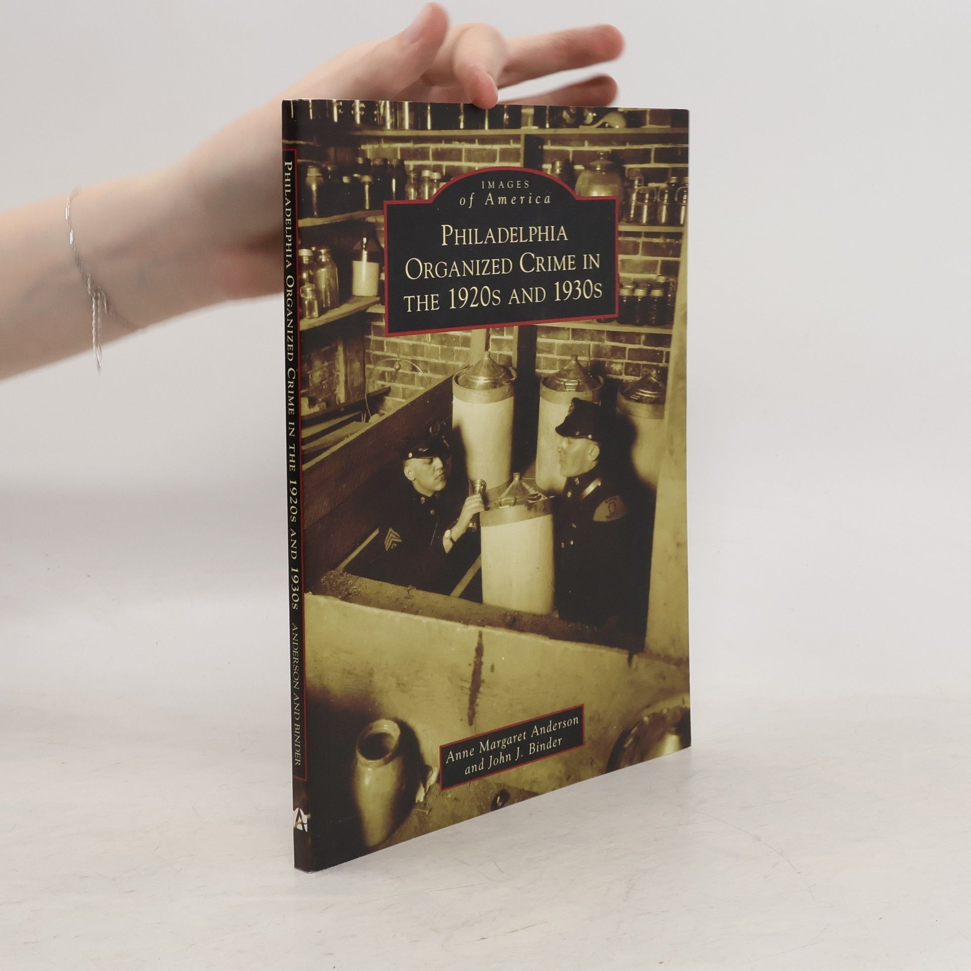
  • Philadelphia Organized Crime in the 1920s and 1930s explores a little-known but spirited chapter of the Quaker City's history. The hoodlums, hucksters, and racketeers of Prohibition-era Philadelphia sold bootleg booze, peddled illicit drugs, ran numbers, and operated prostitution and insurance rings. Among the fascinating personalities that created and contributed to the Philadelphia crime scene of the 1920s and 1930s were empire builders like Mickey Duffy, known as "Prohibition's Mr. Big," and Max "Boo Boo" Hoff, dubbed the "King of the Bootleggers"; the violent Lanzetti brothers, who ran their own illegal enterprise; mobster Harry "Nig Rosen" Stromberg, a New York transplant; and the arsenic widows poison ring, which specialized in fraud and murder. Bringing to light rare photographs and forgotten characters, the authors chronicle the underworld of Philadelphia in the interwar era. The upheaval caused by the gangs and groups herein mirrors the frenzied cultural and political shifts of the Roaring Twenties and the austere 1930s.

    Philadelphia Organized Crime in the 1920s and 1930s
  • A collection of images celebrating the extravagant and historic mansions of Pittsburgh, PA. In the 19th century, the positioning of Pittsburgh as a major manufacturing center and the subsequent rise of the area's steel industry created a wave of prosperity that prompted the beneficiaries of that wealth to construct extravagant residences. Wealthy enclaves sprang up in the city's East End, across the river in neighboring Allegheny City, and into the countryside. Pittsburgh's Mansions explores the stately homes of the area's prominent residents from the 1830s through the 1920s. Businessmen such as H.J. Heinz, Henry Clay Frick, and members of the Mellon family commissioned elaborate homes from the preeminent architects of their day. Firms such as Alden & Harlow, Janssen & Abbott, and Rutan & Russell left their marks on the city's landscape, often contributing iconic public buildings as well as expansive private homes. Though many of the residences have since been lost, Pittsburgh's Mansions offers a look back at the peak of the city's prominence.

    Pittsburgh's Mansions
  • Avondale

    • 128pagine
    • 5 ore di lettura

    In the early 1850s, most of what is now Avondale Borough was a large wheat field situated in portions of both New Garden and London Grove Townships. Early Avondale consisted of a stone bridge, four houses, a blacksmith shop, a tailoring shop, a bark mill, and several limekilns. The village, centered on State Street, was served by the Philadelphia and Baltimore Central Railroad and two mail routes. Led by visionary residents such as James Watson, Ziba Lamborn, Chandler Phillips, and Joel B. Pusey, the village grew rapidly in the late 1860s. Recognizing the opportunities provided by Avondale's rail connection to numerous markets and shipping points, these residents purchased land, constructed buildings, and began operating the businesses that became the foundation for the development of Avondale. Through vintage photographs, Avondale celebrates the growth and daily life of this community.

    Avondale
  • Pocono Township got its name from the Native Americans, meaning "water between the mountains." Many small towns and villages dotted the landscape along the Native American trails, notably Tannersville in Pocono Township, which was named for its leather tanneries. Jackson Township was named after Andrew Jackson, the seventh United States president, and was primarily a farming and logging community. Jackson Township also became a major supplier of ice, which was harvested on the man-made lakes. The ice was transported on the Wilkes-Barre and Eastern Railroad from the depot in Reeders to Philadelphia, New York, and Jersey City. Over the years, the townships' family and honeymoon resorts, pristine streams for trout fishing, and clear mountain air have helped the area become known as "Pennsylvania's Playground."

    Pocono and Jackson Townships
  • The Children's Hospital of Philadelphia started thanks to a heroic doctor's inspiration, was the first of its kind and still impacts children's lives today. The Children's Hospital of Philadelphia opened its doors in 1855 amidst a turbulent time in the city. Dr. Francis West Lewis, a prominent Philadelphia physician, was deeply disturbed by the appallingly high mortality rate among infants and children in his city, a result of the poor sanitary conditions in the urban slums that arose in great numbers during the Industrial Revolution. After visiting London for the opening of Great Ormond Street Hospital, Dr. Lewis was inspired to open the first children's hospital in the United States in Philadelphia and advertised in the Public Ledger, "Reception of children suffering from acute diseases and accidents will be received free of charge." The Children's Hospital continued to prosper and lead the advancement of children's health by creating many of the nation's first pediatric training programs and leading in the discovery of vaccines, lifesaving medical equipment, and pioneering treatments. Today, the hospital enjoys international recognition and continues to contribute to the advancement of children's health through a three-part mission of patient care, education, and research.

    The Children's Hospital of Philadelphia
  • Around Dallastown

    • 128pagine
    • 5 ore di lettura

    Officially incorporated in 1866, the site of Dallastown was once used as a parade ground by local militia during the Revolutionary War era. When James Peeling purchased 95 acres in the area in 1841, he set in motion the community's formation. In 1844, the town was officially named Dallastown, in honor of Philadelphia lawyer and vice president elect George M. Dallas. The final decades of the 19th century saw even more development for Dallastown. The first cigar factory in town opened in 1860, and by 1885, over 38 factories were in operation, creating new jobs, attracting new businesses, and more than doubling the population. Marking its sesquicentennial in 2016, the community of Dallastown continues to celebrate its borough and its unique history.

    Around Dallastown
  • The National Road in Pennsylvania serves as a rich tapestry of American history, tracing its origins from Native American trails to a vital military and expansion route. Built in the early 1800s, it became the first federally constructed road and is now recognized as a National Scenic Byway. The route features significant historical landmarks, including the site of George Washington's early military defeat, David Bradford's home from the Whiskey Rebellion, and the first cast-iron bridge in America. It showcases toll houses, coal mines, and memorials, encapsulating the region's diverse heritage.

    The National Road in Pennsylvania
  • Located on a seven-mile peninsula on the shores of Lake Erie in Erie, Pennsylvania, Presque Isle State Park attracts four million visitors each year. With its designation in 1921, Presque Isle became the second state park in Pennsylvania. From this beginning, the citizens of Erie and surrounding areas developed an affinity and appreciation for the park. Presque Isle has been left relatively unchanged over the years, and when improvements have been made, they have been executed in ways that have not altered the park's natural beauty. Through images gathered from the collections of the author, Erie County Historical Society, Pennsylvania Department of Conservation and Natural Resources, and various other local sources, Presque Isle State Park reflects the history and unique atmosphere of a park that has come to be known as "a place for all seasons."

    Presque Isle State Park
  • The story begins in 1848, when the Moravian Brethren sold 274 acres of farmland to investors who resold them as building lots. By 1855, Asa Packer had laid the tracks of his Lehigh Valley Railroad along the Lehigh River, bringing coal from Carbon County to markets in New York and Philadelphia. Industries rapidly grew, with the Pennsylvania and Lehigh Zinc Company in 1853 and the Saucona Iron Company in 1857. By 1865, South Bethlehem became a borough. Charles M. Schwab headed the former Iron Company in 1906, renaming it the Bethlehem Steel Corporation, and was instrumental in uniting the Bethlehems as one city in 1918. Countless immigrants shaped the tone of this region. Today the Sands Casino occupies part of the former Bethlehem Steel site. It is the future home of art and music venues that will contribute to a city already known for its historic and cultural heritage.

    South Bethlehem
  • Set in the vibrant town of Farrell, established in 1912 and known as "The Magic City," the narrative explores its transformation from swampy woodlands to a bustling hub of culture and community. With a diverse population of Southern and Eastern European emigrants, Farrell boasted a unique blend of nationalist churches and independent businesses. By the mid-20th century, it gained recognition for its sports achievements and artistic representation. Despite challenges like mill closures, the town evolved, featuring its own library and hospital by the 1990s.

    Farrell
  • Ridgway

    • 128pagine
    • 5 ore di lettura

    Ridgway, known as the alily of the valley, a is located on the scenic Clarion River in Pennsylvaniaas Allegheny Mountains. Ridgwayas history has long been closely linked to the river, from a time when residents utilized the water to float timber from the nearby forested hills and supplied lumber for operations around the nation. Much of the beautiful hardwood craftsmanship is preserved today and on display in the elegant Victorian mansions of Ridgwayas former lumber barons. The county seat of Elk County, Ridgway has never let the decline of the lumber industry affect its vitality, and today it is a peaceful, artistic community that draws tourists with its idyllic location. Through historic photographs, Ridgway chronicles the history of this progressive community that remains committed to preserving its past, as well as its future.

    Ridgway
  • Annville Township

    • 130pagine
    • 5 ore di lettura

    Annville Township, located on the north bank of Quittapahilla Creek, was originally settled in the 1720s by millers who made use of the creek's power and surrounding farmland. As the town grew, several hotels were constructed; and in 1817, the Berks-Dauphin Turnpike was built as a toll road through the town. By 1840, Annville had 500 people, log and limestone houses, stores, taverns, churches, schools, and an academy. The arrival of the railroad in 1860 led to the building of factories to the east for the manufacture of flour, shirts, hosiery, handkerchiefs, and shoes. As the new industrialists built their Victorian mansions yet farther east, they completed a living timeline of Annville's history that extends from west to east and from mill to mansion.

    Annville Township
  • South Fayette Township

    • 128pagine
    • 5 ore di lettura

    South Fayette Township was created in 1842. Located 12 miles southwest of Pittsburgh, what is today known as "Pittsburgh's Best-Kept Secret" includes the populations of seven community zip codes. Originally, mining was the township's primary industry, as it is located on some of the richest bituminous coal reserves in the state. Thousands of barrels of oil used to be produced daily. Cemeteries contain memorials to Revolutionary and Civil War veterans as well as the two world wars. The legendary Mike Fink (of Disney World fame) was born here in Sturgeon. Some agricultural farms and horse/riding facilities still dot the hilly countryside among the many new housing developments. The township has a great soccer history and an ever-expanding excellent school district, one of seven in Allegheny County named among America's most challenging schools by the Washington Post. Today, South Fayette Township maintains a rural feel with a motto of "A great place to live, work and play."

    South Fayette Township
  • Springfield Township, Montgomery County, adjoins the city of Philadelphia on its northern border. The township's six-plus square miles, originally established as "Penn's Manor of Springfield," was a gift from William Penn to his wife, Gulielma Maria Springett, c. 1681. This historic township was home to a major stagecoach line and its associated taverns and inns, considerable activity during the Revolutionary War, summertime residences of Philadelphia's wealthy, and subsequent post-World War II development as a burgeoning community just over the Philadelphia border. Springfield Township's rich history is pictorially represented with a number of previously unpublished photographs from the township historical societ, and wonderful private collections. In these pages, travel through the early colonial and farming settlements of the township's original settlers, the turbulence of the Revolutionary War, the arrival of the iron horse, the excitement of White City Amusement Park, the rise and fall of the great mansions and estates, and the explosion of new development as city residents and businesses moved out to the suburbs.

    Springfield Township, Montgomery County
  • Cherry Run Valley

    : Plumer, Pit Hole & Oil City

    • 130pagine
    • 5 ore di lettura

    In 1855, the Cherry Run Valley was a quiet farming community in Venango County in northwestern Pennsylvania. The small town of Plummerville was the largest settlement in all of Cherry Run. Oil City, then know as Cornplanter, was little more then Hasson's Cornfield and Gristmill. Pithole was the home to several pioneers who had each acquired plots of four hundred acres from the Holland Land Company. However, on August 27-28, 1859, Col. Edwin L. Drake and Uncle Billy successfully struck oil near Titusvilleacross Oil Creek in north Venango County. As the news spread to the world, an onslaught of curious reporters, speculators, and adventurers filled the valley. Farms were bought and leased to investors and then often subleased before a well was even bored. Life was about to change dramatically for the people of the Cherry Run Valley. Images from private, local collections make Cherry Run Valley: Plumer, Pithole, and Oil City a true local treasure. From the earliest days to the first sighting of the new commodity to the migration down the length of Oil Creek, the Cherry Run Valley weathered it all. Plumer remains a beautiful village at the entrance to Oil Creek State Park, and Pithole went from buckwheat farm to boomtown to ghost town and now a popular state museum and park. This truly unique place and its history are captured in this long-awaited volume.

    Cherry Run Valley
  • New Brighton Revisited

    • 128pagine
    • 5 ore di lettura

    New Brighton is nestled along the east bank of the Beaver River. The Constable brothers laid out the town's first lots in 1815. The surveyors then named the town New Brighton after their hometown on the southern coast of England. New Brighton Revisited is another entertaining look at the town's rich historical past. Citizens who were prominent in promoting the growth and prosperity of the town included Sen. Samuel White, Joseph T. Pugh, Francis Reader, and Daniel Corbus. Businesses such as Pioneer Twine Mills, Wisener and Bingham Carriage Factory, E.R. Boots Dry Goods, J.J. Snellenburg Clothiers, Bestwick Hardware, Martsolf Brothers Furniture Company, Pryde-Wynne Company, Locke's Service Stations, Morell's Pizza Shop, and Pullion's Paints and Supplies all helped to shape New Brighton's development into what it has become today. New Brighton Revisited takes a nostalgic journey into the town's sports history, dating back to 1896. The community has seen a revitalization in the past year, with new businesses moving into the historic downtown area.

    New Brighton Revisited
  • Millvale

    • 128pagine
    • 5 ore di lettura

    Authors Bill Stout and Jean Domico delve into the hidden history, growth and development of Millvale, laid out with historic images throughout the centuries. Located three miles up the Allegheny River from Pittsburgh, Millvale was built along the valley formed by the creek called Girty's Run. Named after the iron mill of Graff, Bennett & Co., the mill in the valley, Millvale attracted hardworking German, Irish, and Slavic immigrants. Many of Millvale's immigrants created their own small businesses and social organizations, such as the Baeuerlein Brewing Company, as shown on the cover, and St. Anthony's Music and Benevolence Society. They built schools and churches, including St. Nicholas Croatian Catholic Church, internationally famous for its Maxo Vanka murals. Prussian brothers Anton and Andrew Kloman established a small forge making uniquely superior railroad axles. Needing capital to expand, the brothers turned to Miller, Phipps, and Carnegie as partners. Kloman and Company became the birthplace of Pittsburgh's steel industry. Never annexed by Pittsburgh, Millvale governs independently, even owning and operating its own water and electric plants.

    Millvale
  • Brentwood

    • 128pagine
    • 5 ore di lettura

    Brentwood Borough, established in 1915, spans one of the highest ridges in Allegheny County, Pennsylvania, just six miles southeast of Pittsburgh. In the 19th century, three small villages, four inns, and several blacksmith shops clustered along the rural ridge. A popular and primitive roadway, now known as Brownsville Road, connected these three hamlets with the wider world. This major artery carried coaches, wagons, livestock, and even escaping slaves to Pittsburgh. At least one of the four inns was a stop on the Underground Railroad. Many years later, the community established a 28-acre park, complete with shelter house and swimming pool, as well as the later additions of ball fields, tennis courts, and a football stadium. In keeping with its original focus on education, the community has maintained its own school district. Brownsville Road, as a main street, has supported several viable shopping districts. Brentwood is renowned for its annual Fourth of July parade, attracting tens of thousands of spectators each year. Today, Brentwood encompasses 1.45 square miles. The strength of this small community lies with its residents, who value service and commitment. For 100 years, Brentwood has maintained its own distinct character and charm, combining the elements of a modern community with the friendliness of a small town.

    Brentwood
  • Meadville, settled by David Mead in 1788, was established 100 miles from Pittsburgh and Buffalo in the French Creek Valley of northwest Pennsylvania. The city's population grew from 500 in 1810 to more than 10,000 at the end of the 20th century. The construction of residential, institutional, commercial, and industrial buildings burgeoned, and the diverse cultural heritage of the residents dictated a wide variety of architecture. Meadville's Architectural Heritage captures how the citizens of Meadville have retained portions of the grand architecture and have continued efforts to find new uses and functions for many historic buildings.

    Meadville's Architectural Heritage
  • The Conrad Weiser Area

    • 128pagine
    • 5 ore di lettura

    In 1729, John Conrad Weiser, the most famous citizen of the area, joined his fellow Germans and built his homestead just east of present-day Womelsdorf. The settlement grew in the 1800s with a turnpike, a canal, a railroad, and more highways. Villages were started, and three became boroughs. Womelsdorf is the oldest borough in the western part of Berks County, while Robesonia and Wernersville were railroad towns laid out in the 1850s. Some remain villages to this day. Stouchsburg grew up around the turnpike and the canal. Charming Forge was the first industry in the area, and the village still looks like it did 200 years ago. The remaining parts of the area are rural, and some of the best growing soil is found in the Conrad Weiser area. In 1954, seven municipalities joined to form the Conrad Weiser Area School District. This book covers photographs from 1900 until the 1960s and includes all municipalities.

    The Conrad Weiser Area
  • Forbes Field

    • 128pagine
    • 5 ore di lettura

    Forbes Field, constructed in 1909 under the guidance of Pirates president Barney Dreyfuss, marked a significant development in sports history as the first concrete and steel facility in the National League. It quickly became a beloved venue, witnessing the Pirates' World Series victory and hosting memorable events for the Steelers and collegiate football teams, including the University of Pittsburgh's national championships. The site also featured notable boxing matches, solidifying its reputation as a sports mecca, with its remaining wall serving as a testament to its rich legacy.

    Forbes Field
  • Allentown, the Queen City of the Lehigh Valley, is the youngest but largest of the three cities in the valley. Founded in 1762 by William Allen, it was little more than a crossroads and small market town along the Lehigh River until it became the county seat in 1812. Heavy industries based on iron developed in the mid-eighteenth century along the Lehigh River and, by the 1860s, Allentown had become the largest community in the Lehigh Valley. In 1867, Allentown became a city. In Allentown, readers nostalgic for times past will find photographs showing the places they remember from years ago, the Pennsylvania Power & Light tower, and the effects of the devastating floods on the Lehigh River. Equally, newcomers who have heard about the great department stores of Hamilton Street, the trolley systems, Central Park, the breweries, and the iron and silk industries will treasure the images in this volume. Many places that still exist are shown in Allentown as they appeared in their earlier days. Perusing these pages will evoke memories and will provide opportunities for parents and grandparents to introduce a younger generation to the city as it was in their youth.

    Allentown
  • Pittsburgh's Point Breeze

    • 128pagine
    • 5 ore di lettura

    Named for the famous early-19th-century Point Breeze Hotel that stood at the corner of what is now Fifth and Penn Avenues, Point Breeze has been home to some of the wealthiest families in Pittsburgh and the country. Moguls such as Carnegie, Westinghouse, Frick, Mellon, and Thaw all resided in Point Breeze, thus christened "Pittsburgh's Most Opulent Neighborhood." H.J. Heinz owned the first car in Pittsburgh, which was garaged at his estate in North Point Breeze, and present-day Wilkins Avenue was originally the private road to the 650-acre estate of senator, ambassador to Russia, and judge William Wilkins. However, many of these prestigious estates were later razed and divided to become smaller residential lots, driving the real estate market to create more homes to accommodate 20th-century families. In later years, the Point Breeze neighborhood became the home of several well-known authors, including Annie Dillard, Albert French, and David McCullough, as well as professional athletes Willie Stargell of the Pirates and L.C. Greenwood of the Steelers and everyone's favorite neighbor, Mr. Rogers.

    Pittsburgh's Point Breeze
  • Located in Chester County, Pennsylvania, West Whiteland Township was established in 1765 when Whiteland Township divided into “East” and “West.” Readers can glimpse into the past at establishments such as The Guernsey Cow restaurant, Strawbridge & Clothier, and the Valley Creek Coffee House. A chapter on Richard Downing provides firsthand accounts by quoting personal letters of his life in West Whiteland in the 1850s. There are beautiful photographs from the time when riders chased foxes as members of the Whiteland Hunt. The township began to change after the invention of the automobile; for over 100 years, the area had primarily been a farming community, until businesses began to spring up along Lincoln Highway and Pottstown Pike. With rapid development in the late 1970s and 1980s, many historic buildings were saved through the preservation efforts of the West Whiteland Historical Commission.

    West Whiteland Township
  • Looming on the outskirts of Philadelphia County since 1906, the mental hospital most commonly known as "Byberry" stood abandoned for 16 years before being demolished in 2006. At its peak in the 1960s, Byberry was home to more than 6,000 patients and employer to more than 800. With its own self-sustaining farm, bowling alleys, barbershop, ice cream parlor, federal post office, and baseball team, Byberry was a micro-community. Throughout its history, the hospital served as an educational institution for Philadelphia's medical, nursing, and psychology students; was the site of a World War II Civilian Public Service conscientious objector unit; and a volunteering hot spot for local churches, schools, and Girl and Boy Scout troops. This book provides an unprecedented window into the good, the bad, the unusual, and the forgotten history of Byberry.

    Byberry State Hospital
  • Exploring the vibrant jazz scene of Pittsburgh, this book highlights the city's rich musical heritage shaped by local artists and iconic venues. It delves into the improvisational magic born in smoke-filled clubs and the unique styles that emerged, ultimately influencing the evolution of bebop. Featuring a collection of photographs taken by Pittsburgh Courier photographers from the 1930s to the 1980s, it captures the essence of an era that drew jazz musicians from around the world to experience the Steel City's artistic legacy.

    Pittsburgh Jazz
  • Around Selinsgrove

    • 130pagine
    • 5 ore di lettura

    The book highlights Selinsgrove's rich history and unique identity, shaped by its establishment as a coeducational college and its role in the flour trade before the Pennsylvania Canal. It showcases the town's recreational heritage, including the popular Rolling Green Park and the renowned Selinsgrove Speedway. Through over 200 photographs, many unpublished, it captures the individuals and events that have defined the community, offering a visual journey through Selinsgrove's past and its significance along the Susquehanna River.

    Around Selinsgrove
  • Scranton

    • 96pagine
    • 4 ore di lettura

    After incorporation in 1866, Scranton demonstrated an indomitable spirit that made it the Electric City and the Anthracite Capital of the World. Nestled in the scenic Lackawanna River Valley, Scranton carried that spirit through the changing economic landscape of the mid-20th century as its coal, railroad, and textile industries declined. In a cityscape that recalls its past, Scranton continues to find creative uses for its iconic structures. The community of Scranton embraces growth and change while celebrating its rich heritage with traditions like trips to the Saturday farmers' market at the historic Iron Furnaces, rides along the old Laurel Line trolley tracks to a RailRiders baseball game, celebrations of rich ethnic heritage at festivals throughout the year, and many more.

    Scranton
  • Established by German immigrants in the early 19th century, the Jewish community of Greater Harrisburg flourished, growing to 600 residents by the century's end. Its civic engagement surpassed that of similar settlements, while early 20th-century immigration from Eastern Europe significantly expanded the population and transformed its ethnic landscape. The community developed a wide array of institutions and became a central hub for Jewish life in Pennsylvania, producing notable figures in Jewish affairs, business, and the arts.

    Greater Harrisburg's Jewish Community
  • Scranton's Hill Section

    • 128pagine
    • 5 ore di lettura

    The hills east of Scranton's downtown are home to one of the most eclectic and historic neighborhoods in America. Scranton's aptly named Hill Section developed over the course of the 19th and 20th centuries, from what was originally rugged terrain and dense forest to a socially diverse enclave. The area's close proximity to Scranton's commercial center and unparalleled views of the Lackawanna Valley attracted many of Scranton's wealthiest and most prominent citizens, including the city's namesake Scranton family, to build palatial mansions in a myriad of architectural styles on its many hills. Middle-class citizens soon followed suit, building smaller but equally splendid homes alongside their elite neighbors. To serve the Hill Section's growing population, civic leaders organized religious and community institutions, and local merchants developed commercial enterprises. Ultimately, the Hill Section became home to many well-known educational and medical centers, beautiful parks, and cultural establishments. In the 21st century, the Hill Section is still a thriving community that continues to preserve its heritage. Scranton's Hill Section tells the story of a distinctive neighborhood full of diverse people whose legacies are the true embodiment of American history.

    Scranton's Hill Section
  • Named for Versailles Palace in honor of the French allies during the American Revolution, Versailles Township was one of the original seven townships of Allegheny County. Wedged among the Monongahela, Youghiogheny, and Turtle Creek Valleys, the region was a prime spot for the growth of industrial, commercial, and residential plans. David L. Clark (creator of the Clark Candy Bar), Pittsburgh Steelers founder Art Rooney, Rainbow Gardens, and Olympia Park were all products of the region that was Versailles Township. Inevitably, as the population grew, the "Old" Versailles Township split up into several smaller communities, including the Boroughs of East McKeesport, White Oak, Versailles, and the Townships of North and South Versailles.

    Old Versailles Township
  • Around Greensboro

    • 128pagine
    • 5 ore di lettura

    Around Greensboro covers communities of southeastern Greene County, including Greensboro at its heart. Greensboro was originally called Delight by the Mingo Indians who lived in the region. Because of its location on the Monongahela River, it quickly became an important trading location for the trappers and settlers moving through in the late 1700s. Later, Albert Gallatin introduced a group of Belgian glassblowers to the area, and in 1807, the glassworks in Greensboro was opened. As the glass business began to fade, another took its place. The area was rich in clay, which would be vital to the development of the pottery industry. From the 1840s to 1915, pottery was king in Greensboro, and the town boomed. As the pottery industry faded, it too would be replaced by another industry: coal. Greensboro, once famous for its glass and pottery, became known for its bituminous coal mines. This book covers the early days of Greensboro to the devastating Election Day Flood of 1985.

    Around Greensboro
  • Zelienople

    • 128pagine
    • 5 ore di lettura

    In 1800, Butler County had just been created and was nothing but forest, streams, and Indian trails. Dettmar Basse purchased 10,000 acres in this wilderness, where he hoped to create a barony similar to the ones he had known in Germany. In 1802, he started to build his Bassenheim (Basse's home). It took seven years and $7,000 to build this castle, and he also laid out streets for a town that he named for his daughter Zelie (nople means village). Zelie and her new husband, Philippe Passavant, of French ancestry, traveled here in 1807 and became the first merchants on Main Street. Their son William A. Passavant founded numerous orphanages and hospitals throughout the country. Christian Buhl, the hatter and furrier, came to Zelienople from Germany in 1802. His grandson Henry Buhl Jr. founded Boggs and Buhl Department Store on the north side of Pittsburgh. In 1927, he bequeathed an $11-million endowment to the Buhl Foundation, making it one of the best-funded foundations in the country.

    Zelienople
  • YARDLEY

    • 128pagine
    • 5 ore di lettura

    In the eighteenth century, a ferry and mill marked the crossroads beginnings of Yardleyville in Makefield Township. New modes of transportation transformed the village, commerce and industry flourished, and the populationincreased substantially. Soon the people of Yardley yearned for their own governmenttheir own townand Yardley, Pennsylvania, was incorporated in 1895. Yardley is a unique, detailed look at the birth and growth of the borough. When Yardley Borough celebrated its centennial, donations and loans of photographs revealing Yardleys history were collected. This volume is compiled mostly from this locally assembled selection of images, and recounts Yardleys history with eloquence. These pages revisit the cigar stores, trolley tracks, ice cream shops, schools, the intersection of Main and Afton, and many other well-known sites throughout the borough. The face of the old toll collector, the festivities of the Canal Days and Harvest Day celebrations, and countless days at Lake Afton, the canal, or the river are all captured in this treasured account of Yardleys past.

    YARDLEY
  • Focusing on the Landis family's duality as both typical Pennsylvania Germans and cultural pioneers, this book chronicles their life in Lancaster County from the 18th century. Henry Harrison and Emma Caroline Landis raised their children in a cross-cultural setting, fostering an appreciation for Mennonite and Reformed traditions. Through historic photographs, many previously unpublished, the narrative showcases their contributions to American culture and documents their family life, customs, and agricultural practices, enriching the understanding of Pennsylvania German heritage.

    The Landis Family: A Pennsylvania German Family Album
  • Mount Pleasant is a small borough in the Laurel Highlands of Westmoreland County with an immeasurable history. Originally a Native American trail, Main Street was used by Gen. Edward Braddock in 1755 on his journey to his 16th encampment. Generations have lived here since the town was incorporated in 1828. Many immigrants from Poland, Italy, Germany, and Ireland came here to work in the coal, coke, and glass industries, which were growing quickly and spurring successful businesses. The coke works of Henry Clay Frick was established in 1881. Bryce Brothers Glass began in 1896 and became well known for blown stemware and tableware. L.E. Smith Glass Company manufactured handmade American pressed glass in various colors and styles beginning in 1907. The success of these industries led to the Glass Festival, held annually in September. Today, in the center of town is Diamond Memorial Square, the quintessential symbol of Mount Pleasant, where the World War I doughboy was erected in 1924. Mount Pleasant Borough, Westmoreland County shares photographs and stories that illustrate the strong community ties of the area.

    Mount Pleasant Borough, Westmoreland County
  • Lawrenceville

    • 128pagine
    • 5 ore di lettura

    From its founding in 1814 by William Barclay Foster, Lawrenceville has been the center of historic events. During the Civil War, the riverside community became home to the Allegheny Arsenal, where 78 people perished in an explosion in 1862, making it the worst civilian disaster of the war. Lawrenceville evolved into a lively, walkable neighborhood that barely slept because of the high volume of shift workers at places such as Iron City Brewery, St. Francis Hospital, and the steel mills. Businesses, churches, all-night diners, and other gathering places were easily accessible to residents, and families became closely associated with the landmarks where they worked, worshipped, and socialized. Having celebrated its 200th birthday in 2014, Lawrenceville remains a bustling community with a vitality equal to that of the immigrant days, and it continues to be a place of camaraderie where individuals are dedicated to their neighborhood.

    Lawrenceville
  • The history of Philadelphia television is the history of television in America. Philo Farnsworth, credited with inventing television, performed some of his earliest experiments at the Franklin Institute and at 1230 Mermaid Lane. Those experiments led to the city's first television station, W3XE. Channel 3 was also the first local station in the country to broadcast in color. WCAU-TV Channel 10 constructed the first building in the world designed specifically as a television station. WFIL created one of the most iconic shows in television history, American Bandstand, as well as Action News, which has helped Channel 6 stay on top of the ratings for most of the last 40 years. Dick Clark, Ed McMahon, Ernie Kovacs, Tom Snyder, David Brenner, Maury Povich, Kelly Ripa, Brian Williams, and others are among those who have worked in Philadelphia television throughout its history.

    Philadelphia Television
  • In 1818, Deacon Elijah Fay planted the first grape vines of the Lake Erie Wine Country, located in the Lake Erie Concord Grape Belt. Fay's relatives planted the premier Concord vineyards in Brocton, New York, where the mighty Concord grape thrived. Vineyards were planted along the shore of Lake Erie in both New York and Pennsylvania, attracting the likes of Dr. Charles Welch, who relocated his grape juice operations to Westfield, New York, in 1897. Regional wineries sprung up during the grape boom of the 19th century but went out of business due to Prohibition in 1919. While New York permitted commercial wineries after Prohibition, it was not until 1968 when wineries were allowed to reopen in Pennsylvania. Today, the Grape Belt spans almost 60 miles along the southern shore of Lake Erie. Quaint towns dot the Grape Belt, which is now home to the Grape Discovery Center and boutique wineries that welcome thousands of visitors each year.

    Lake Erie Wine Country
  • The National Road in Pennsylvania serves as a historical tapestry, tracing its origins from Native American trails to a pivotal military roadway. Established in the early 1800s, it was the first federally constructed road in the U.S., facilitating westward expansion. Along its ninety-mile stretch, significant sites include the first cast-iron bridge, historic taverns, and remnants of the Whiskey Rebellion. Today recognized as a National Scenic Byway, the road showcases vital landmarks and memorials that reflect America's rich history and development.

    National Road in Pennsylvania
  • In 1805, Indiana Township became the fourth township formed in Allegheny County. The earliest settlers, Jacob Huddle (Hodil) and Henry Strohm, arrived from Germany in 1798. The township was mainly rural when it was first settled, but as time progressed, the inevitable "coal culture" began. Coal mining was ideal for three main reasons: the rich coal deposits found within the landscape, the vast array of rail systems, and proximity to the Allegheny River. Important areas in the community include the Singing Winds site of the Council of the Three Rivers American Indian Center, the Mary Flinn Lawrence Estate (commonly referred to as "Hartwood Acres"), the Harmarville Rehabilitation Center, Consulate Health Care, and Beechwood Farms Nature Reserve (currently in Fox Chapel Borough but formerly in Indiana Township), which is home to the Audubon Society of Western Pennsylvania. The famous stage actress Fay Templeton made Indiana Township her home for a time at Wunnahunny Farm, now called Humes's Farm.

    Indiana Township
  • Juniata's River Valleys

    • 128pagine
    • 5 ore di lettura

    Exploring the rich history of the Juniata River valleys, the book highlights the region's transformation from ancient Native American pathways to vital transportation routes like the Pennsylvania Railroad. It chronicles the area's industrial contributions, including iron and lead, and its evolution into a recreational haven with hiking trails and waterways. Vintage photographs and personal images provide a nostalgic look at life along this beautiful waterway, showcasing its significance in both past and present.

    Juniata's River Valleys
  • Settled in 1708 and incorporated as a borough in 1827, Elizabethtown, Pennsylvania, is located five miles from the Susquehanna River in Lancaster County, 20 miles from both the county seat Lancaster City, to the east, and Harrisburg, the state capital, to the west. With its Old Peter's Road, Elizabethtown played an important role in the westward expansion of the nation during the 18th and 19th centuries. Construction on the first railroad began in 1834, and Elizabethtown remains a strategic stop on the Amtrak Keystone line between Harrisburg and Philadelphia. Along with its proximity to Hershey, Pennsylvania, Elizabethtown has been home to a Mars, Inc., confectionery plant since 1970 (formerly Klein's Chocolate Company, incorporated in 1914). Elizabethtown College was founded in 1899, and the Masonic Village followed in 1910. The Pennsylvania State Hospital for Crippled Children opened in 1929, later becoming the Pennsylvania Department of Corrections Training Academy in 1991.

    Elizabethtown
  • Saucon Valley

    • 128pagine
    • 5 ore di lettura

    Before the first European settlers arrived in the Saucon Valley, the local Native American tribe, the Lenape, named the 17-mile, eastern Pennsylvania creek Saucon, meaning "at the mouth of the creek." Saucon Valley refers to the area drained by the Saucon Creek, a tributary of the Lehigh River. The valley includes Hellertown and Lower Saucon Township in Northampton County. Lower Saucon Township was chartered in 1743, when it was still a part of Bucks County. The township also included South Bethlehem until 1865, and Hellertown until 1872. Before becoming a borough in 1872, Hellertown was the largest village in Lower Saucon Township for many years. Even though the two municipalities remain separate, it is today impossible to disunite the families, culture, and history that have been interwoven through the years.

    Saucon Valley
  • Conneaut Lake

    • 130pagine
    • 5 ore di lettura

    The narrative explores the rich history of Conneaut Lake, Pennsylvania, highlighting its formation by glacial activity and its evolution from Evansburg to its current name in 1892. The town's unique features, such as the iconic ship structure at Oakland Beach Hotel and the ice harvesting industry, are vividly depicted. Today, the lake serves as a hub for recreational activities like skiing and fishing, boasting the record for Pennsylvania's largest Muskie catch. Additionally, the establishment of Channellock, Inc. in 1886 adds a notable industrial facet to the town's heritage.

    Conneaut Lake
  • When the first Italian moved to the area near Catherine Street around 1798, it was mostly forest and field. It was considered Irishtown by the early residents. By 1852, an Italian church had been established for the community, and from the advent of mass migration beginning in 1876 grew Philadelphia's Little Italy. The original neighborhood was bound by the area from Sixth Street to Eleventh Street and Bainbridge to Federal Streets. Many of the early families--Baldi, Pinto, and Fiorella--established businesses in the area that continue today. Other beautiful buildings still left standing are remnants of the once thriving banking industry in this little neighborhood. As time progressed, the market expanded beyond its local neighbors. Italians throughout Philadelphia developed their own Little Italy communities to the north, west, and farther south of the original boundaries.

    South Philadelphia's Little Italy and 9th Street Italian Market